


The best hiking routes in High Weald National Landscape
Discover the best walks in High Weald National Landscape. 5 routes on the map, with descriptions, photos and GPX.
About High Weald National Landscape
The High Weald National Landscape is a dense, intricate patchwork of ancient woodland, sunken lanes, and small, irregular pastures. Unlike the open, sweeping chalk downs nearby, this area is defined by its enclosed, intimate scale and a rolling terrain of ridges and valleys. The landscape is shaped by its underlying geology of hard sandstones and soft clays, which historically supported a thriving iron industry. Today, you will notice this history in the numerous hammer ponds and the deeply incised gill woodlands where streams have cut through the sandstone bedrock.
Read more
About High Weald National Landscape
The High Weald National Landscape is a dense, intricate patchwork of ancient woodland, sunken lanes, and small, irregular pastures. Unlike the open, sweeping chalk downs nearby, this area is defined by its enclosed, intimate scale and a rolling terrain of ridges and valleys. The landscape is shaped by its underlying geology of hard sandstones and soft clays, which historically supported a thriving iron industry. Today, you will notice this history in the numerous hammer ponds and the deeply incised gill woodlands where streams have cut through the sandstone bedrock.
Read moreThe High Weald National Landscape is a dense, intricate patchwork of ancient woodland, sunken lanes, and small, irregular pastures. Unlike the open, sweeping chalk downs nearby, this area is defined by its enclosed, intimate scale and a rolling terrain of ridges and valleys. The landscape is shaped by its underlying geology of hard sandstones and soft clays, which historically supported a thriving iron industry. Today, you will notice this history in the numerous hammer ponds and the deeply incised gill woodlands where streams have cut through the sandstone bedrock.
Underfoot, the paths vary significantly depending on the underlying geology. Walking along the ridge tops often means following dry, sandy tracks, whereas dropping down into the valleys and clay vales brings you onto heavy clay soils that retain moisture. Many of the historic paths are holloways, ancient tracks worn down several metres below the surrounding field levels by centuries of use by livestock and travellers, framed by exposed tree roots and high banks.
In spring, particularly during April and May, the ancient woodlands are carpeted with bluebells and wild garlic, making these shaded sections highly distinct from the open pastures. While the area lacks high peaks or dramatic vistas, it offers a complex network of interconnected footpaths that require careful navigation. Popular spots near historic villages can be busier, but the extensive network of quiet woodland paths allows for long, solitary walks through a working agricultural landscape.
Hiking routes in High Weald National Landscape (5)

#1. 1066 Country Walk

#2. European walking route E9, Queen Elizabeth Country Park to Jevington

#3. European walking route E9, Rye to Dover
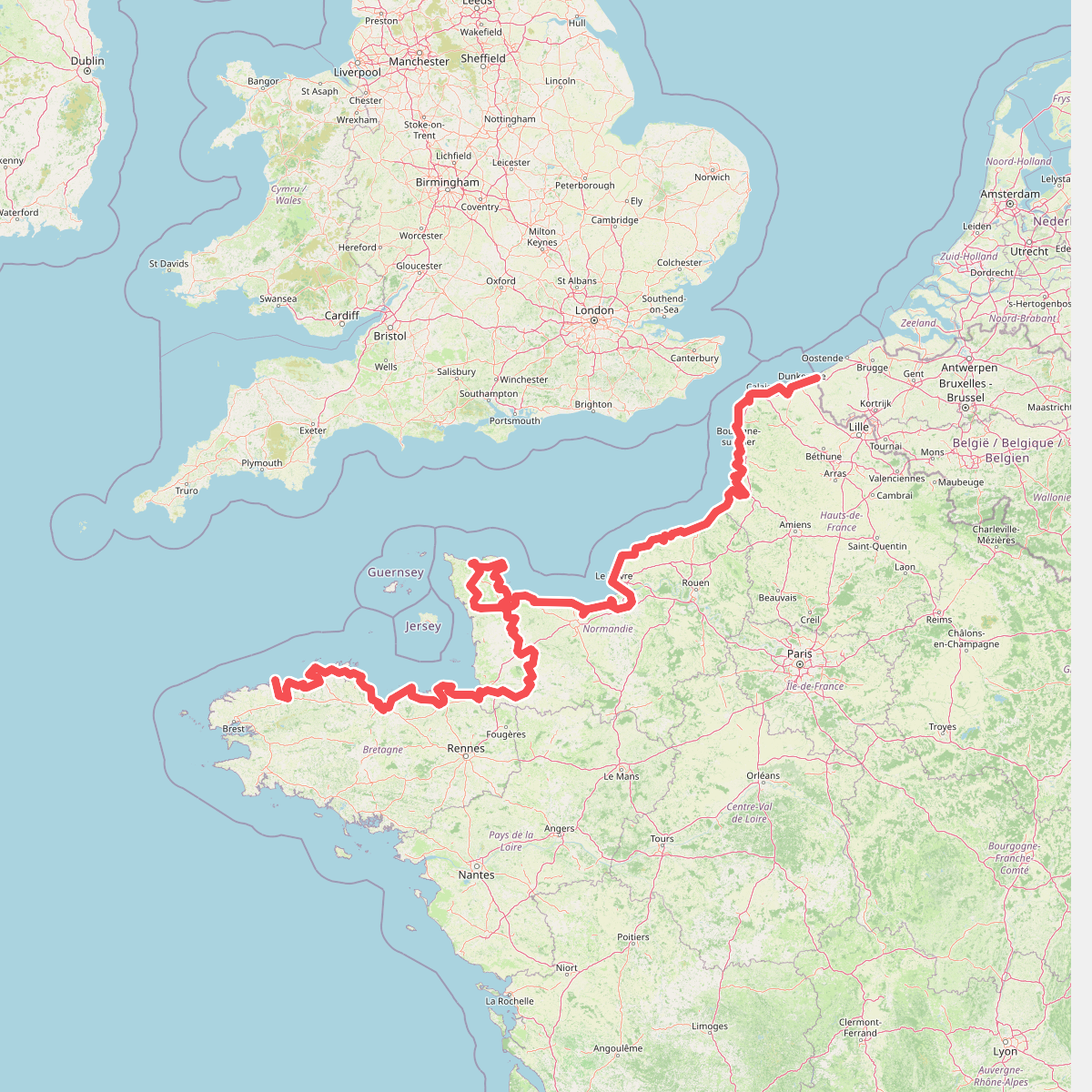
#4. Eurovelo 4
Roscoff,Saint-Pol-de-Léon,Plouénan,Taulé,Saint-Martin-des-Champs,Morlaix,Plouezoc'h,Plougasnou,Saint-Jean-du-Doigt,Guimaëc,Locquirec,Plestin-les-Grèves,Saint-Michel-en-Grève,Ploumilliau,Ploubezre,Lannion,Trébeurden,Pleumeur-Bodou,Trégastel,Perros-Guirec,Louannec,Camlez,Penvénan,Plouguiel,Trédarzec,Pleumeur-Gautier,Lézardrieux,Paimpol,Plouézec,Plouha,Tréveneuc,Binic-Étables-sur-Mer,Pordic,Plérin,Saint-Brieuc,Langueux,Hillion,Lamballe-Armor,Pléneuf-Val-André,Erquy,Fréhel,Plévenon,Pléboulle,Matignon,Saint-Cast-le-Guildo,Beaussais-sur-Mer,Tréméreuc,Plouër-sur-Rance,Saint-Suliac,Saint-Père-Marc-en-Poulet,Saint-Malo,Saint-Coulomb,Cancale,Saint-Méloir-des-Ondes,Hirel,Cherrueix,France métropolitaine,Roz-sur-Couesnon,Pontorson,Courtils,Céaux,Poilley,Ducey-les-Chéris,Isigny-le-Buat,Grandparigny,Romagny Fontenay,Saint-Clément-Rancoudray,Sourdeval,Vire Normandie,Souleuvre-en-Bocage,Pont-Bellanger,Tessy-Bocage,Fourneaux,Condé-sur-Vire,Bourgvallées,Saint-Lô,Agneaux,Pont-Hébert,Airel





