


The best hiking routes in SIC Comprensorio Tolfetano-Cerite-Manziate
Discover the best walks in SIC Comprensorio Tolfetano-Cerite-Manziate. 22 routes on the map, with descriptions, photos and GPX.
About SIC Comprensorio Tolfetano-Cerite-Manziate
The SIC Comprensorio Tolfetano-Cerite-Manziate presents a rugged, low-lying volcanic landscape that differs sharply from the manicured farmland closer to Rome. Walkers here will encounter a mosaic of dense oak woods, open pastureland, and deep tufa gorges carved by seasonal streams. The terrain is defined by gently rolling hills of volcanic origin, meaning you will not find high alpine peaks or deep glacial valleys, but rather a undulating plateau where dark volcanic rock frequently breaks through the soil.
Read more
About SIC Comprensorio Tolfetano-Cerite-Manziate
The SIC Comprensorio Tolfetano-Cerite-Manziate presents a rugged, low-lying volcanic landscape that differs sharply from the manicured farmland closer to Rome. Walkers here will encounter a mosaic of dense oak woods, open pastureland, and deep tufa gorges carved by seasonal streams. The terrain is defined by gently rolling hills of volcanic origin, meaning you will not find high alpine peaks or deep glacial valleys, but rather a undulating plateau where dark volcanic rock frequently breaks through the soil.
Read moreThe SIC Comprensorio Tolfetano-Cerite-Manziate presents a rugged, low-lying volcanic landscape that differs sharply from the manicured farmland closer to Rome. Walkers here will encounter a mosaic of dense oak woods, open pastureland, and deep tufa gorges carved by seasonal streams. The terrain is defined by gently rolling hills of volcanic origin, meaning you will not find high alpine peaks or deep glacial valleys, but rather a undulating plateau where dark volcanic rock frequently breaks through the soil.
Underfoot, the tracks vary between dusty clay paths, loose volcanic gravel, and rough stone tracks that require sturdy footwear. In the wooded sections, particularly around the beech forest of Monte Raschio, the path is shaded and covered in leaf litter, while the open pastures are crisscrossed by dirt tracks shared with free-roaming Maremmana cattle and horses. The vegetation changes noticeably with the geology, shifting from acid-loving chestnut woods on the volcanic heights to Mediterranean scrub on the lower clay slopes.
This area is ideal if you prefer self-guided exploration along quiet, often poorly signposted forestry tracks rather than highly developed tourist trails. While the famous birch wood of Manziana attracts local walkers on spring weekends, much of the wider reserve remains quiet and feels remarkably wild. It is a landscape to be read through its ancient pastoral use, where wide firebreaks and old charcoal-burning platforms still shape the woodland paths you walk on today.
Hiking routes in SIC Comprensorio Tolfetano-Cerite-Manziate (22)

#1. Ara del Tufo

#2. Bandita

#3. Cammino dei tre villaggi
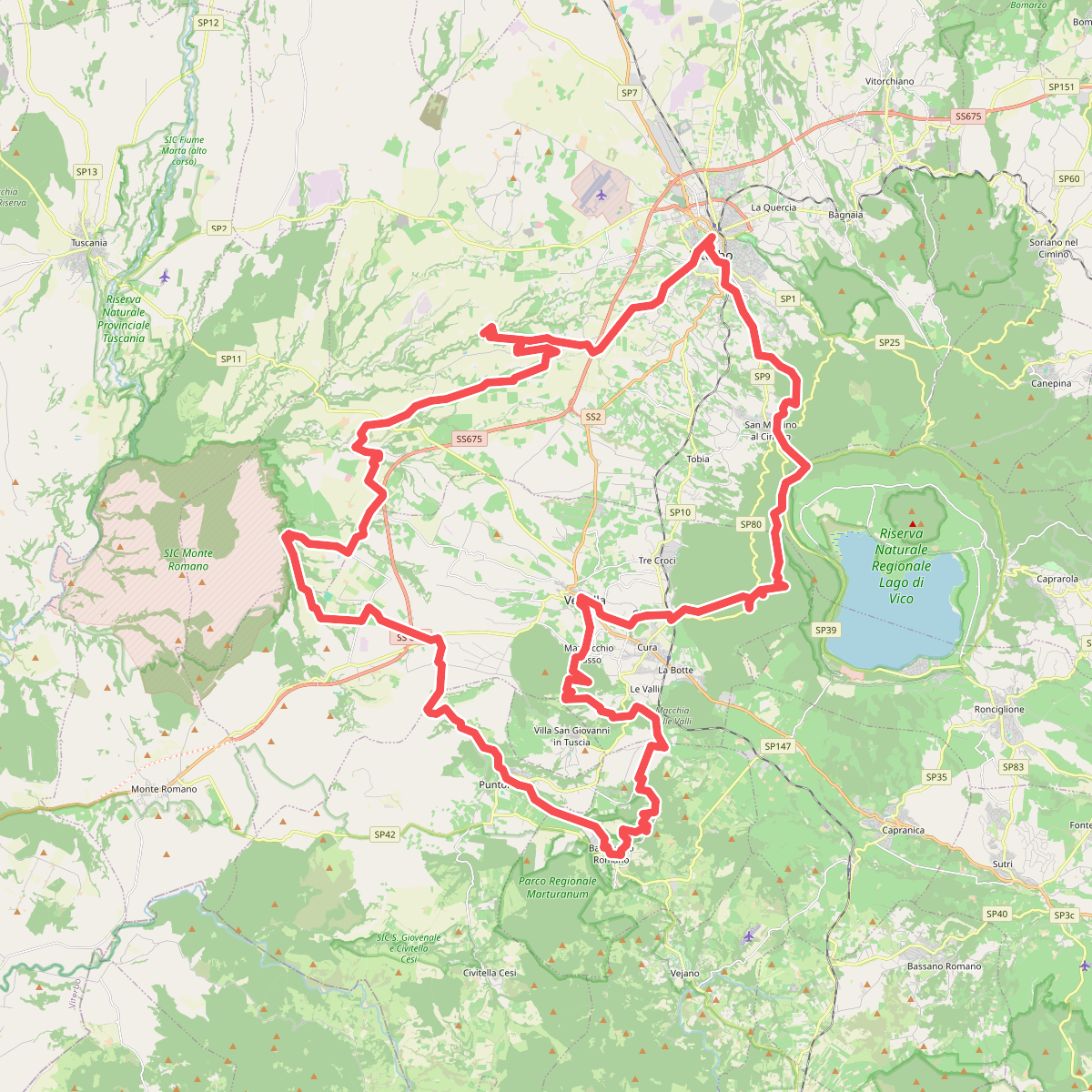
#4. Cammino Rosso

#5. Cammino Tuscia Tappa 6

#6. Cammino Tuscia Tappa 7

#7. Cammino Tuscia Tappa 8

#8. Civitella Cesi
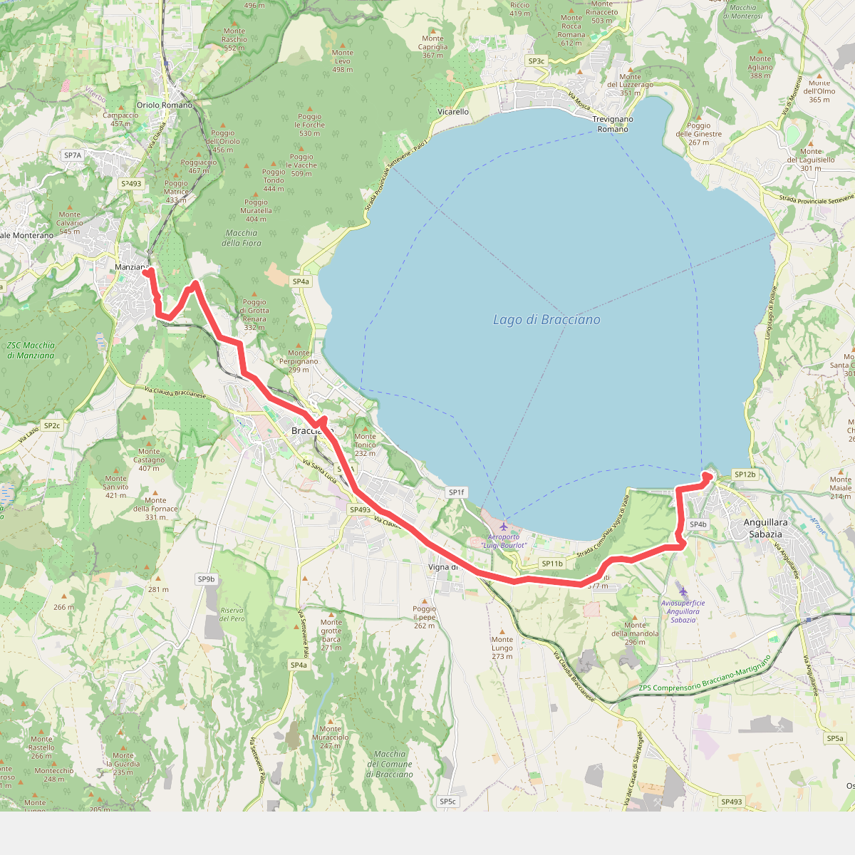
#9. Il Cammino dei Vulcani - Tappa 4

#10. Il Cammino dei Vulcani - Tappa 5

#11. Il Cammino dei Vulcani - Tappa 6





