


The best hiking routes in Markermeer & IJmeer
Discover the best walks in Markermeer & IJmeer. 76 routes on the map, with descriptions, photos and GPX.
Managed by Domeinen;Staatbosbeheer
About Markermeer & IJmeer
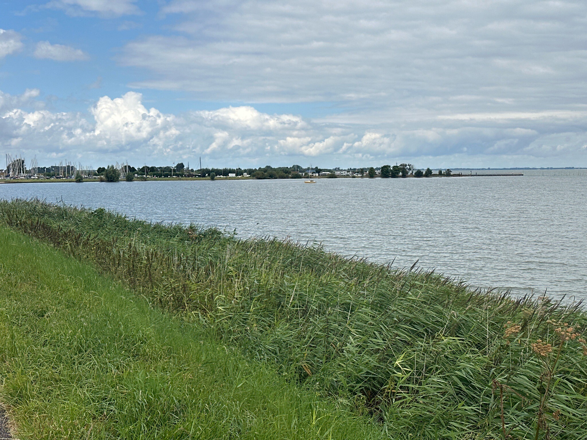
The Markermeer & IJmeer area is a vast, open freshwater landscape defined by its massive artificial dikes, shallow lake margins, and newly created marshy archipelagos. Walking here means navigating long, straight asphalt paths atop stone-reinforced dikes, or exploring the softer, unpaved clay and sand tracks of the Marker Wadden. Unlike traditional Dutch woodlands or heathlands, this is a completely flat, water-dominated environment where the main features are reeds, willow scrub, and engineered stone barriers.
Read more
About Markermeer & IJmeer
The Markermeer & IJmeer area is a vast, open freshwater landscape defined by its massive artificial dikes, shallow lake margins, and newly created marshy archipelagos. Walking here means navigating long, straight asphalt paths atop stone-reinforced dikes, or exploring the softer, unpaved clay and sand tracks of the Marker Wadden. Unlike traditional Dutch woodlands or heathlands, this is a completely flat, water-dominated environment where the main features are reeds, willow scrub, and engineered stone barriers.
Read moreThe Markermeer & IJmeer area is a vast, open freshwater landscape defined by its massive artificial dikes, shallow lake margins, and newly created marshy archipelagos. Walking here means navigating long, straight asphalt paths atop stone-reinforced dikes, or exploring the softer, unpaved clay and sand tracks of the Marker Wadden. Unlike traditional Dutch woodlands or heathlands, this is a completely flat, water-dominated environment where the main features are reeds, willow scrub, and engineered stone barriers.
Underfoot, you will encounter a stark contrast between the hard, wind-exposed concrete of the outer dikes and the sandy, boardwalk-lined trails of the newer nature islands. The landscape is a direct result of twentieth-century water management, which cut off these waters from the sea. On the path, this history is visible in the massive sluices and the sudden transition from deep shipping channels to shallow, bird-rich mudflats.
The area is highly exposed, with little to no tree cover to offer shade or shelter. While the mainland dike paths are popular with cyclists and long-distance walkers, the island trails offer a quieter, more enclosed experience among dense reedbeds. It is a landscape of vast horizontal lines, where the interest lies in watching waterbirds and observing how land is actively reclaimed from the water.
Hiking routes in Markermeer & IJmeer (76)


#1. Durgerdam - Amsterdam, Flevopark · Zuiderzeepad etappe 6
Amsterdam


#2. Edam busstation - Monnickendam · Zuiderzeepad etappe 4
Monnickendam,Katwoude,Volendam,Edam


#3. Hoorn - Ursem · Westfriese Omringdijk etappe 1
Ursem,Avenhorn,Noordbeemster,Oudendijk,Scharwoude,Berkhout,Hoorn


#4. Klokbekerweg, Lely - Hollandse Hout · Pionierspad etappe 6
Lelystad


#5. Monnickendam - Durgerdam · Zuiderzeepad etappe 5
Amsterdam,Zuiderwoude,Uitdam,Monnickendam


#6. Scharwoude - Edam busstation · Zuiderzeepad etappe 3
Edam,Middelie,Warder,Oosthuizen,Beets,Schardam,Avenhorn,Berkhout


#7. Station Weesp - Muiderberg · Westerborkpad etappe 3
Weesp,Muiden,Muiderberg


#8. Wijdenes - Hoorn · Westfriese Omringdijk etappe 8
Hoorn,Schellinkhout,Wijdenes


#9. Enkhuizen - Wijdenes · Westfriese Omringdijk etappe 7
Wijdenes,Venhuizen,Hem,Enkhuizen


#10. Muiderberg - Blaricum · Zuiderzeepad etappe 8


#11. Palingroute (rood) vanaf startpunt Monnickendam
Monnickendam,Katwoude,Volendam,Edam


#12. Station Diemen - Station Weesp · Westerborkpad etappe 2
Amsterdam,Diemen,Weesp




