


The best hiking routes in Supramonte di Oliena, Orgosolo e Urzulei - Su Sercone
Discover the best walks in Supramonte di Oliena, Orgosolo e Urzulei - Su Sercone. 10 routes on the map, with descriptions, photos and GPX.
About Supramonte di Oliena, Orgosolo e Urzulei - Su Sercone
Supramonte di Oliena, Orgosolo e Urzulei - Su Sercone is a vast limestone plateau characterized by severe karst topography, where the ground is a maze of sharp, white limestone rocks, deep sinkholes, and dry gorges. Unlike softer mountain ranges, there are no gentle grassy ridges or running surface streams here. Walkers must navigate a stark, gray landscape where water immediately drains into the rock, leaving the surface dry and heavily eroded. The defining feature of the area is Su Sercone, a massive, crater-like sinkhole that opens up suddenly in the middle of the limestone plateau, its sheer walls dropping down to a sheltered basin where giant, ancient holm oaks manage to grow.
Read more
About Supramonte di Oliena, Orgosolo e Urzulei - Su Sercone
Supramonte di Oliena, Orgosolo e Urzulei - Su Sercone is a vast limestone plateau characterized by severe karst topography, where the ground is a maze of sharp, white limestone rocks, deep sinkholes, and dry gorges. Unlike softer mountain ranges, there are no gentle grassy ridges or running surface streams here. Walkers must navigate a stark, gray landscape where water immediately drains into the rock, leaving the surface dry and heavily eroded. The defining feature of the area is Su Sercone, a massive, crater-like sinkhole that opens up suddenly in the middle of the limestone plateau, its sheer walls dropping down to a sheltered basin where giant, ancient holm oaks manage to grow.
Read moreSupramonte di Oliena, Orgosolo e Urzulei - Su Sercone is a vast limestone plateau characterized by severe karst topography, where the ground is a maze of sharp, white limestone rocks, deep sinkholes, and dry gorges. Unlike softer mountain ranges, there are no gentle grassy ridges or running surface streams here. Walkers must navigate a stark, gray landscape where water immediately drains into the rock, leaving the surface dry and heavily eroded. The defining feature of the area is Su Sercone, a massive, crater-like sinkhole that opens up suddenly in the middle of the limestone plateau, its sheer walls dropping down to a sheltered basin where giant, ancient holm oaks manage to grow.
Underfoot, the terrain is exceptionally rough and demanding. There are no paved paths or smooth dirt tracks; instead, you will walk over sharp limestone pavements, loose scree, and uneven bedrock that requires constant attention to balance. Navigation can be difficult because the gray rock formations look highly similar in every direction, and traditional trail markings are sparse. The vegetation consists of tough, low macchia scrub, thorny bushes, and scattered, wind-shaped holm oaks that find a foothold in the rock crevices.
In May, the harshness of the limestone is briefly softened by wild peonies blooming in the shaded dolines, though the overall character remains arid and exposed. This area is not suitable for a casual stroll or for those seeking lush green valleys and easy, signposted loop walks. It appeals instead to self-reliant walkers who want to experience a raw, silent karst wilderness where the geology is completely exposed.
Hiking routes in Supramonte di Oliena, Orgosolo e Urzulei - Su Sercone (10)
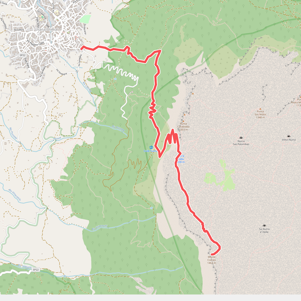
#1. B401 - Oliena - Monte Corrasi
Ulìana/Oliena
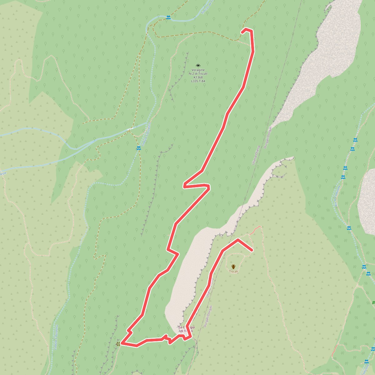
#2. B410 - Su Ruvagliu - Tiscali
Ulìana/Oliena,Durgali/Dorgali
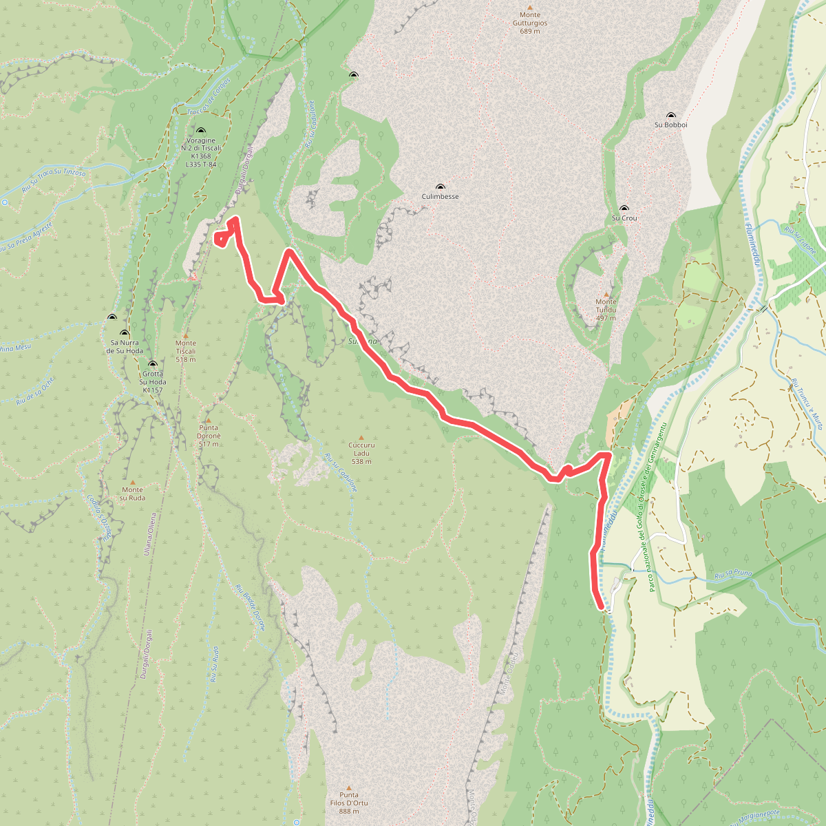
#3. B481 - Ponte S'Abba Arva - Tiscali
Durgali/Dorgali
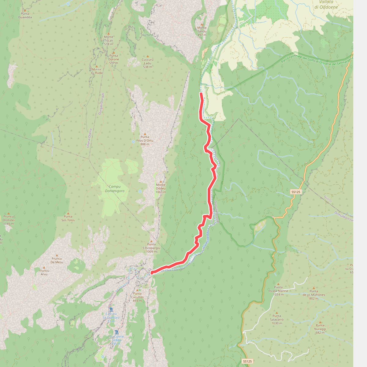
#4. B485 - Ponte S'Abba Arva - Gola di Gorropu
Durgali/Dorgali,Orgòsolo/Orgosolo
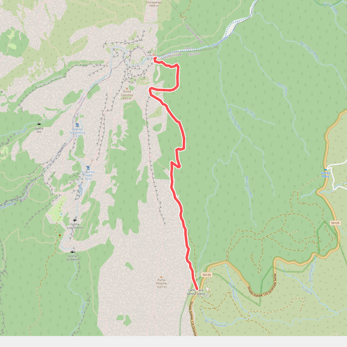
#5. B505 - Ghenna Silana - Gorropu
Orthullè/Urzulei

#6. Sentiero Italia - Sardegna Z00 · SI

#7. Sentiero Italia - Sardegna Z00 · SI

#8. Sentiero Italia · SI

#9. Sentiero Italia · SI





