


The best hiking routes in Fahner Höhe
Discover the best walks in Fahner Höhe. 7 routes on the map, with descriptions, photos and GPX.
About Fahner Höhe
Fahner Höhe is a low, forested limestone ridge rising gently above the Thuringian Basin. Unlike the deeper valleys of nearby regions, this landscape is characterized by a broad, flat-topped plateau covered in dense deciduous woodland, dominated by beech and oak trees. The area lacks dramatic peaks or steep gorges, offering instead a network of wide, gently undulating forest tracks. Underfoot, the paths are primarily packed earth and gravel, which can become sticky clay after wet weather due to the underlying limestone and loess soils.
Read more
About Fahner Höhe
Fahner Höhe is a low, forested limestone ridge rising gently above the Thuringian Basin. Unlike the deeper valleys of nearby regions, this landscape is characterized by a broad, flat-topped plateau covered in dense deciduous woodland, dominated by beech and oak trees. The area lacks dramatic peaks or steep gorges, offering instead a network of wide, gently undulating forest tracks. Underfoot, the paths are primarily packed earth and gravel, which can become sticky clay after wet weather due to the underlying limestone and loess soils.
Read moreFahner Höhe is a low, forested limestone ridge rising gently above the Thuringian Basin. Unlike the deeper valleys of nearby regions, this landscape is characterized by a broad, flat-topped plateau covered in dense deciduous woodland, dominated by beech and oak trees. The area lacks dramatic peaks or steep gorges, offering instead a network of wide, gently undulating forest tracks. Underfoot, the paths are primarily packed earth and gravel, which can become sticky clay after wet weather due to the underlying limestone and loess soils.
What sets this area apart is the transition between the dense, shaded forest of the ridge and the extensive fruit orchards that carpet the southern and eastern slopes. Walkers will notice this abrupt shift from deep woodland canopy to open, structured agricultural land. In April, the lower slopes are defined by the white blossom of thousands of cherry, plum, and apple trees, making the edge of the forest particularly distinct.
While the interior forest tracks feel secluded and are often quiet, the trail margins near the orchard villages of Gierstädt and Döllstädt are more frequented. Walking here is straightforward, with no technical terrain or significant climbing, making it suitable for those seeking steady, rhythmic forest walking rather than varied topography.
Hiking routes in Fahner Höhe (7)
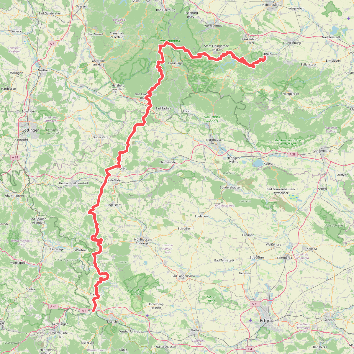
#1. Fernwanderweg Harz – Eichsfeld – Thüringer Wald (HET)

#2. Hauptwanderweg Eisenach – Wernigerode (blaues Andreaskreuz)

#3. Lutherweg Thüringen - Nordroute

#4. Lutherweg Thüringen - Westschlaufe

#5. [THW] Thüringenweg [West - OSM-Teil4]
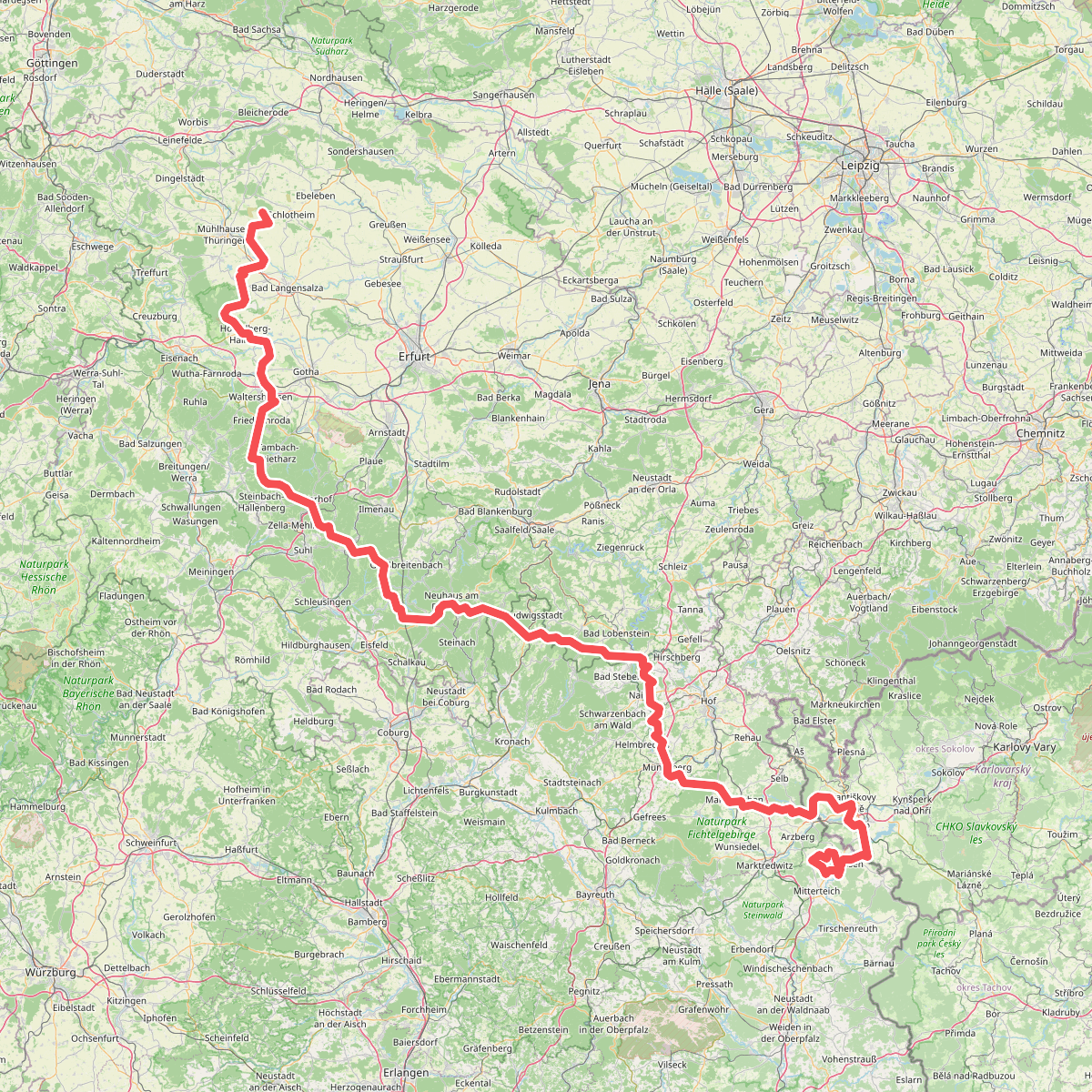
#6. Via Porta





