The best hiking routes in Parc naturel régional du Gâtinais français
Discover the best walks in Parc naturel régional du Gâtinais français. 30 routes on the map, with descriptions, photos and GPX.
About Parc naturel régional du Gâtinais français
The Parc naturel régional du Gâtinais français offers a distinct transition between the agricultural plains of the Île-de-France and the dense forests of Fontainebleau. Walkers here will find a landscape defined by sandstone ridges, quiet valleys, and dry sandy clearings. Unlike the mountain ranges further south, this regional park is characterized by gently rolling hills, woodland paths, and open agricultural fields. The terrain is marked by distinctive sandstone boulders scattered among pine and birch trees, creating a mosaic of dry heathland and shaded woodland tracks.
Read more
About Parc naturel régional du Gâtinais français
The Parc naturel régional du Gâtinais français offers a distinct transition between the agricultural plains of the Île-de-France and the dense forests of Fontainebleau. Walkers here will find a landscape defined by sandstone ridges, quiet valleys, and dry sandy clearings. Unlike the mountain ranges further south, this regional park is characterized by gently rolling hills, woodland paths, and open agricultural fields. The terrain is marked by distinctive sandstone boulders scattered among pine and birch trees, creating a mosaic of dry heathland and shaded woodland tracks.
Read moreThe Parc naturel régional du Gâtinais français offers a distinct transition between the agricultural plains of the Île-de-France and the dense forests of Fontainebleau. Walkers here will find a landscape defined by sandstone ridges, quiet valleys, and dry sandy clearings. Unlike the mountain ranges further south, this regional park is characterized by gently rolling hills, woodland paths, and open agricultural fields. The terrain is marked by distinctive sandstone boulders scattered among pine and birch trees, creating a mosaic of dry heathland and shaded woodland tracks.
Underfoot, the paths vary significantly depending on where you walk. You will encounter loose, sandy tracks that require some effort to traverse, alternating with firm forest soil and occasional rocky passages over the sandstone outcrops. In the lower valleys, particularly near the Essonne and École rivers, the ground shifts to damp meadows and marshy edges where boardwalks occasionally assist. The contrast between the dry, pine-scented sandy plateaus and the damp, reed-lined riverbanks is a constant feature of the landscape.
In May, the broom and gorse bloom across the sandy clearings, painting the dry heathland yellow. The park is easily accessible and well-known spots near the forest edges can be busier on weekends, while the quieter agricultural paths in the south offer a more solitary walking experience. This is a landscape of subtle changes, where the presence of ancient sandstone quarrying is still visible in the shaped rocks and hollows along the trails.
Hiking routes in Parc naturel régional du Gâtinais français (30)

#1. Auvers

#2. chemin de Rumont

#3. Chemin des Grés et des Bruyères

#4. De Buthiers à Pithiviers

#5. De Saint-Fargeau à Buthiers

#6. Du Gâtinais au Morvan, Fontainebleau - Montbouy

#7. Du Val d'Yerres à l'Étampois

#8. European long distance path E3 - part France · relation 12890366
#9. Eurovelo 4
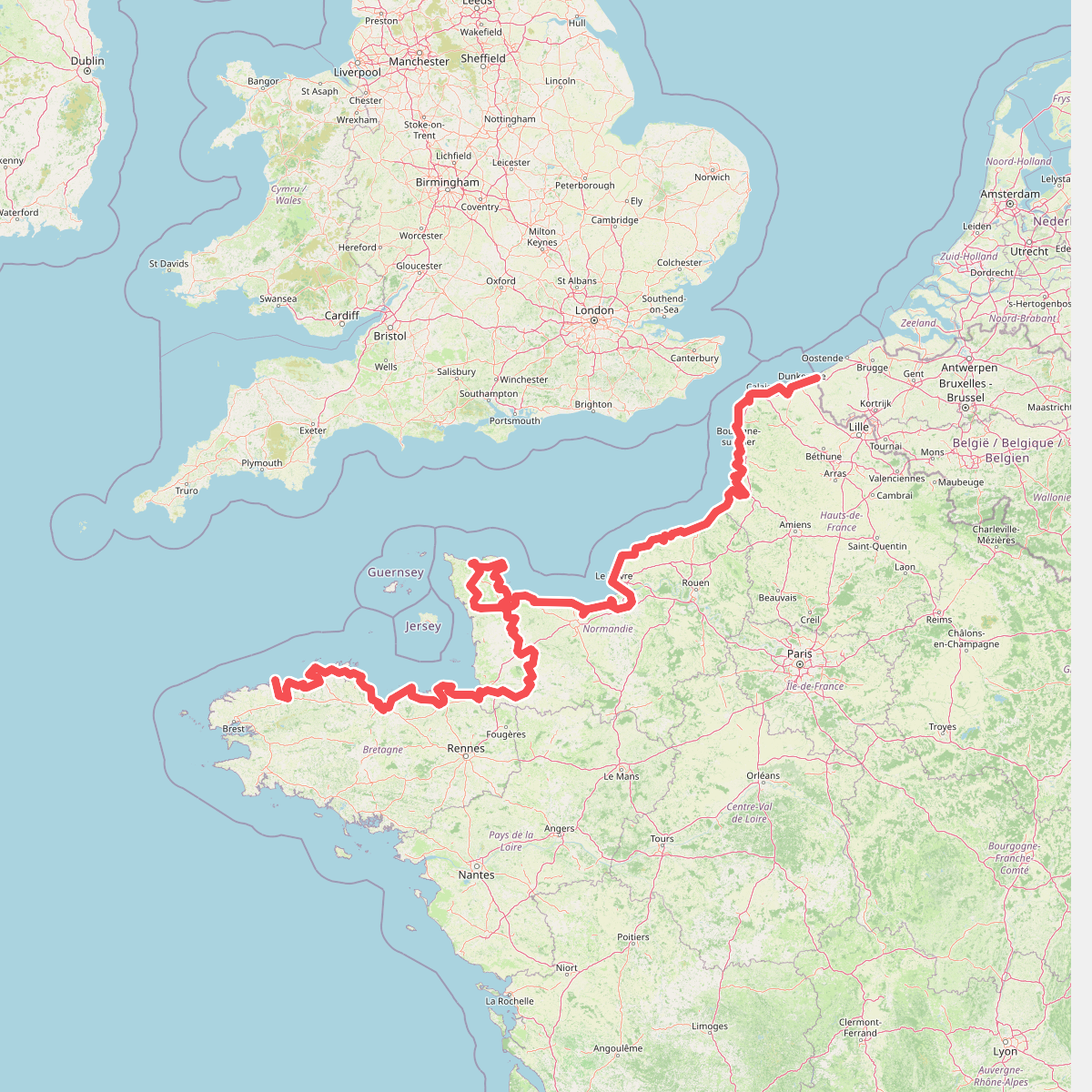
Roscoff,Saint-Pol-de-Léon,Plouénan,Taulé,Saint-Martin-des-Champs,Morlaix,Plouezoc'h,Plougasnou,Saint-Jean-du-Doigt,Guimaëc,Locquirec,Plestin-les-Grèves,Saint-Michel-en-Grève,Ploumilliau,Ploubezre,Lannion,Trébeurden,Pleumeur-Bodou,Trégastel,Perros-Guirec,Louannec,Camlez,Penvénan,Plouguiel,Trédarzec,Pleumeur-Gautier,Lézardrieux,Paimpol,Plouézec,Plouha,Tréveneuc,Binic-Étables-sur-Mer,Pordic,Plérin,Saint-Brieuc,Langueux,Hillion,Lamballe-Armor,Pléneuf-Val-André,Erquy,Fréhel,Plévenon,Pléboulle,Matignon,Saint-Cast-le-Guildo,Beaussais-sur-Mer,Tréméreuc,Plouër-sur-Rance,Saint-Suliac,Saint-Père-Marc-en-Poulet,Saint-Malo,Saint-Coulomb,Cancale,Saint-Méloir-des-Ondes,Hirel,Cherrueix,France métropolitaine,Roz-sur-Couesnon,Pontorson,Courtils,Céaux,Poilley,Ducey-les-Chéris,Isigny-le-Buat,Grandparigny,Romagny Fontenay,Saint-Clément-Rancoudray,Sourdeval,Vire Normandie,Souleuvre-en-Bocage,Pont-Bellanger,Tessy-Bocage,Fourneaux,Condé-sur-Vire,Bourgvallées,Saint-Lô,Agneaux,Pont-Hébert,Airel

#10. Grand Tour de Paris, variante par Ballancourt

#11. Janville