


The best hiking routes in Chichester Harbour National Landscape
Discover the best walks in Chichester Harbour National Landscape. 6 routes on the map, with descriptions, photos and GPX.
About Chichester Harbour National Landscape
Chichester Harbour National Landscape is a low-lying drowned river valley, or ria, where the sea penetrates deep into the flat coastal plain of West Sussex and Hampshire. Unlike open sandy beaches, this area is a complex network of tidal channels, wide mudflats, and saltmarshes. Walkers will find a landscape shaped entirely by the daily rise and fall of the tide, meaning a path that overlooks water in the morning may look out over vast, glistening silt by afternoon. The terrain is consistently flat, offering no hills or elevated vantage points, but rather a horizontal perspective of oak woodlands growing right down to the high-water mark.
Read more
About Chichester Harbour National Landscape
Chichester Harbour National Landscape is a low-lying drowned river valley, or ria, where the sea penetrates deep into the flat coastal plain of West Sussex and Hampshire. Unlike open sandy beaches, this area is a complex network of tidal channels, wide mudflats, and saltmarshes. Walkers will find a landscape shaped entirely by the daily rise and fall of the tide, meaning a path that overlooks water in the morning may look out over vast, glistening silt by afternoon. The terrain is consistently flat, offering no hills or elevated vantage points, but rather a horizontal perspective of oak woodlands growing right down to the high-water mark.
Read moreChichester Harbour National Landscape is a low-lying drowned river valley, or ria, where the sea penetrates deep into the flat coastal plain of West Sussex and Hampshire. Unlike open sandy beaches, this area is a complex network of tidal channels, wide mudflats, and saltmarshes. Walkers will find a landscape shaped entirely by the daily rise and fall of the tide, meaning a path that overlooks water in the morning may look out over vast, glistening silt by afternoon. The terrain is consistently flat, offering no hills or elevated vantage points, but rather a horizontal perspective of oak woodlands growing right down to the high-water mark.
Underfoot conditions vary significantly depending on which shoreline you choose. The shoreline paths alternate between gravelly shingle beaches, firm clay embankments, and soft saltmarsh edges. In many sections, particularly around Bosham and Itchenor, low-lying causeways are prone to tidal flooding, requiring walkers to check local tide tables before setting out. Wooden boardwalks occasionally span the wettest saltmarsh grasses, while inland links follow narrow dirt paths through agricultural fields and hedgerows.
This is a working landscape where recreational walking shares the shoreline with active boatyards, sailing clubs, and oyster fisheries. While the deeper channels remain busy with yachts, the quieter northern reaches of the creeks, such as near Fishbourne, offer views of wading birds feeding in the mud. The area does not provide wilderness isolation, as church spires, historic coastal villages, and distant road noise are frequent companions along the trail.
Hiking routes in Chichester Harbour National Landscape (6)
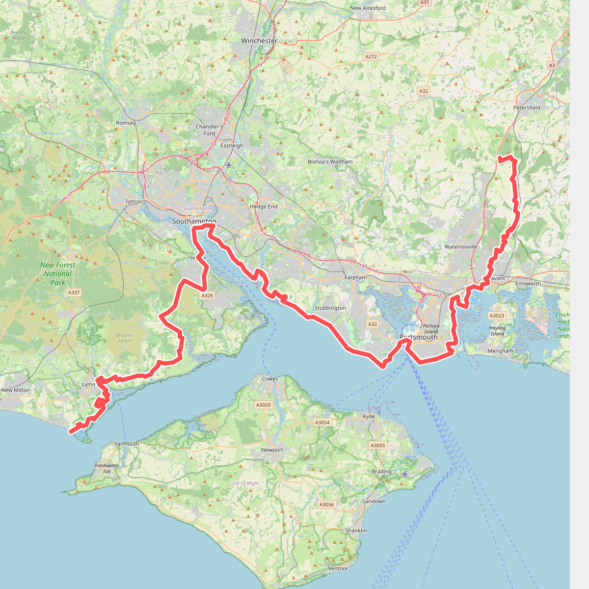
#1. European walking route E9, Milford on Sea to Queen Elizabeth Country Park

#2. European walking route E9, Queen Elizabeth Country Park to Jevington
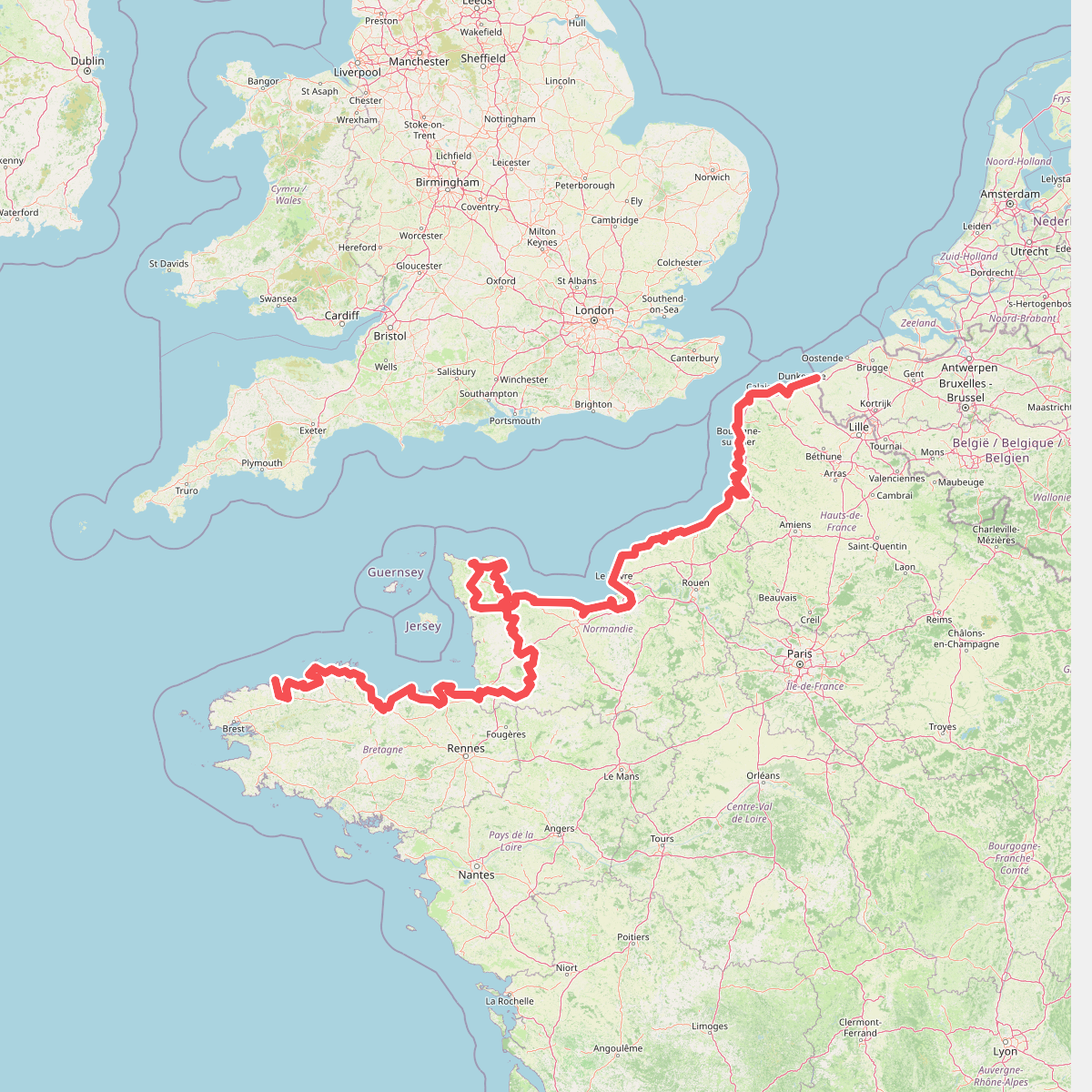
#3. Eurovelo 4
Roscoff,Saint-Pol-de-Léon,Plouénan,Taulé,Saint-Martin-des-Champs,Morlaix,Plouezoc'h,Plougasnou,Saint-Jean-du-Doigt,Guimaëc,Locquirec,Plestin-les-Grèves,Saint-Michel-en-Grève,Ploumilliau,Ploubezre,Lannion,Trébeurden,Pleumeur-Bodou,Trégastel,Perros-Guirec,Louannec,Camlez,Penvénan,Plouguiel,Trédarzec,Pleumeur-Gautier,Lézardrieux,Paimpol,Plouézec,Plouha,Tréveneuc,Binic-Étables-sur-Mer,Pordic,Plérin,Saint-Brieuc,Langueux,Hillion,Lamballe-Armor,Pléneuf-Val-André,Erquy,Fréhel,Plévenon,Pléboulle,Matignon,Saint-Cast-le-Guildo,Beaussais-sur-Mer,Tréméreuc,Plouër-sur-Rance,Saint-Suliac,Saint-Père-Marc-en-Poulet,Saint-Malo,Saint-Coulomb,Cancale,Saint-Méloir-des-Ondes,Hirel,Cherrueix,France métropolitaine,Roz-sur-Couesnon,Pontorson,Courtils,Céaux,Poilley,Ducey-les-Chéris,Isigny-le-Buat,Grandparigny,Romagny Fontenay,Saint-Clément-Rancoudray,Sourdeval,Vire Normandie,Souleuvre-en-Bocage,Pont-Bellanger,Tessy-Bocage,Fourneaux,Condé-sur-Vire,Bourgvallées,Saint-Lô,Agneaux,Pont-Hébert,Airel

#4. King Charles III England Coast Path: East Head to Shoreham

#5. King Charles III England Coast Path: South Hayling to East Head: Alt Route via Warblington





