


The best hiking routes in Saarschleife und Leukbachtal
Discover the best walks in Saarschleife und Leukbachtal. 24 routes on the map, with descriptions, photos and GPX.
About Saarschleife und Leukbachtal
Saarschleife und Leukbachtal presents two distinct landscape characters shaped by water cutting through different geological layers. The southern section is dominated by the dramatic, deep-cut river bend of the Saar, where steep, forested slopes of quartzite and shale drop sharply to the water. In contrast, the northern Leukbachtal offers a gentler, more enclosed valley floor where the Leukbach stream meanders through damp meadows, orchards, and sandstone formations. Walkers will notice this geological transition in the soil and vegetation, moving from dry, acidic oak-beech woods on the rocky heights to lush, moisture-loving alder and ash trees along the stream beds.
Read more
About Saarschleife und Leukbachtal
Saarschleife und Leukbachtal presents two distinct landscape characters shaped by water cutting through different geological layers. The southern section is dominated by the dramatic, deep-cut river bend of the Saar, where steep, forested slopes of quartzite and shale drop sharply to the water. In contrast, the northern Leukbachtal offers a gentler, more enclosed valley floor where the Leukbach stream meanders through damp meadows, orchards, and sandstone formations. Walkers will notice this geological transition in the soil and vegetation, moving from dry, acidic oak-beech woods on the rocky heights to lush, moisture-loving alder and ash trees along the stream beds.
Read moreSaarschleife und Leukbachtal presents two distinct landscape characters shaped by water cutting through different geological layers. The southern section is dominated by the dramatic, deep-cut river bend of the Saar, where steep, forested slopes of quartzite and shale drop sharply to the water. In contrast, the northern Leukbachtal offers a gentler, more enclosed valley floor where the Leukbach stream meanders through damp meadows, orchards, and sandstone formations. Walkers will notice this geological transition in the soil and vegetation, moving from dry, acidic oak-beech woods on the rocky heights to lush, moisture-loving alder and ash trees along the stream beds.
Underfoot, the terrain varies significantly between the two zones. The trails around the Saar loop often climb steeply along narrow, stony paths strewn with loose quartzite scree and exposed tree roots, requiring steady footing. The Leukbachtal paths are generally wider, flatter, and softer, consisting of packed earth and grassy tracks that follow the water level. While the famous clifftop viewpoints overlooking the river bend attract regular visitors, the deeper side valleys and the forested paths along the Leukbach remain much quieter.
This area does not offer high mountain ridges or open, wind-swept plateaus. Instead, the views are intimate and framed by the canopy, opening up primarily at the edges of the river cliffs or where the forest yields to small valley pastures. In May, the forest floor in the damper ravines is often green with fresh wild garlic, while the rocky slopes remain dry and sparse. It is a landscape of vertical contrasts, where the choice lies between demanding climbs on rocky ground and level walks along quiet watercourses.
Hiking routes in Saarschleife und Leukbachtal (24)
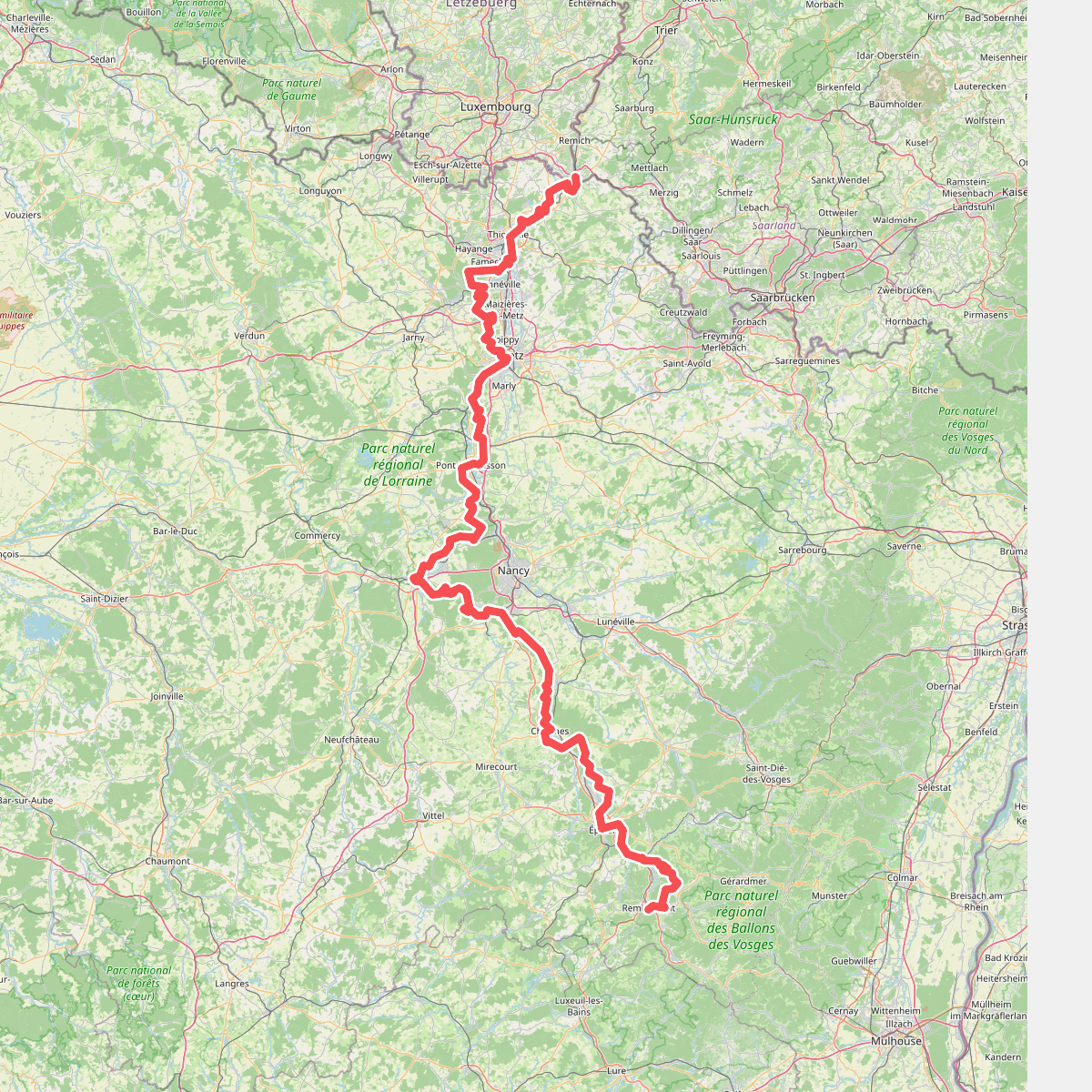
#1. Chemin de la Moselle

#2. Cloefpfad
Mettlach
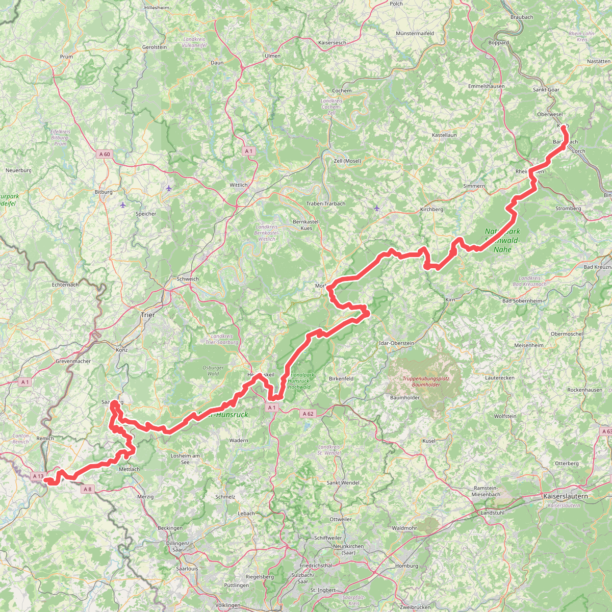
#3. European long distance path E3 - part Saarland, Rheinland-Pfalz
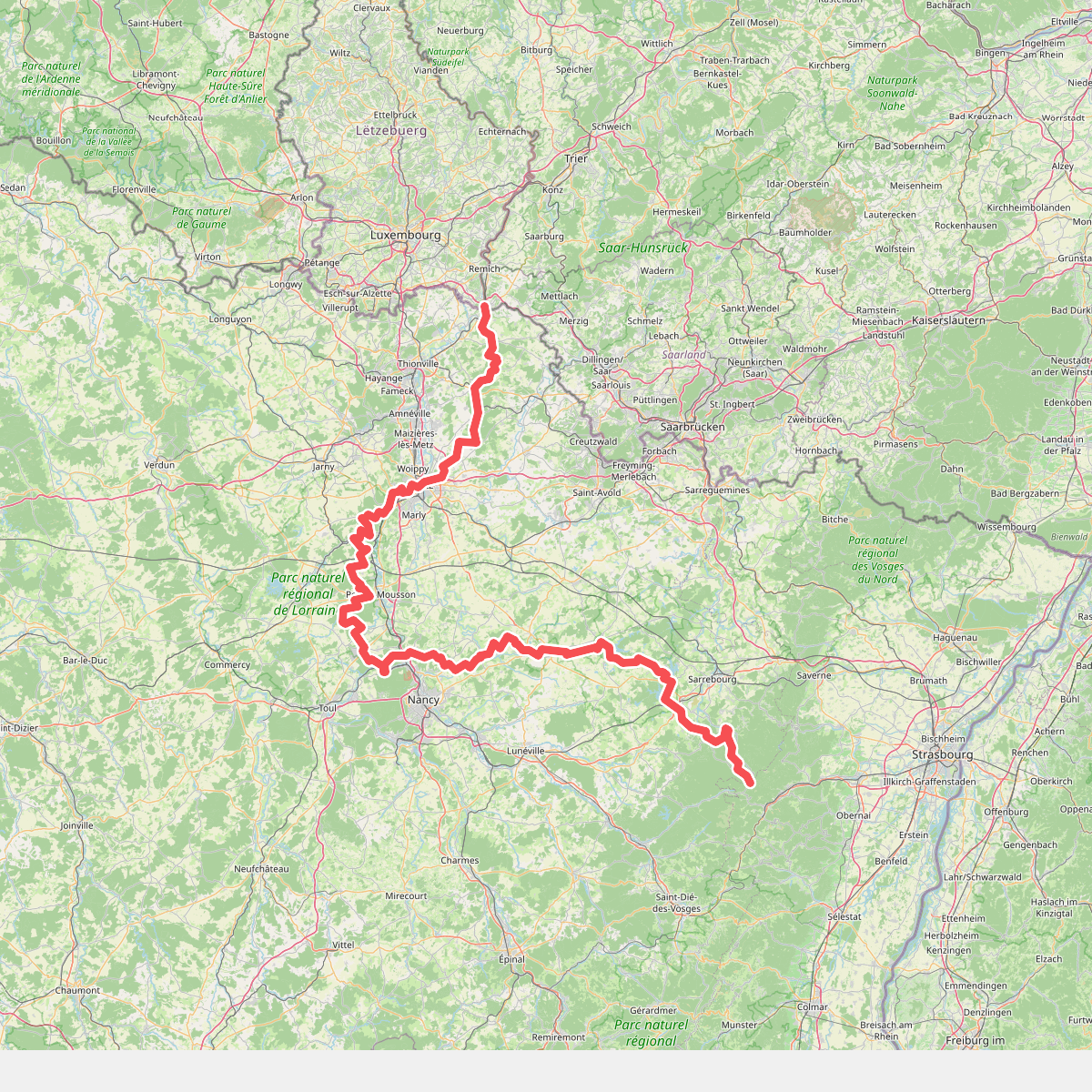
#4. GR 5 Lorraine
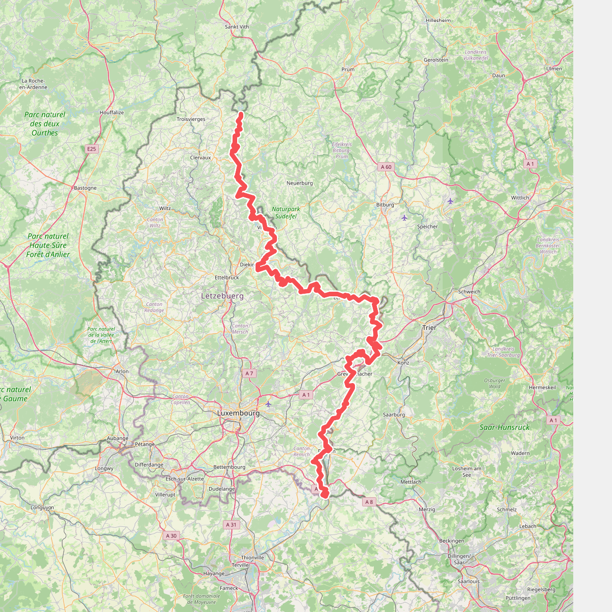
#5. GR 5 Luxembourg
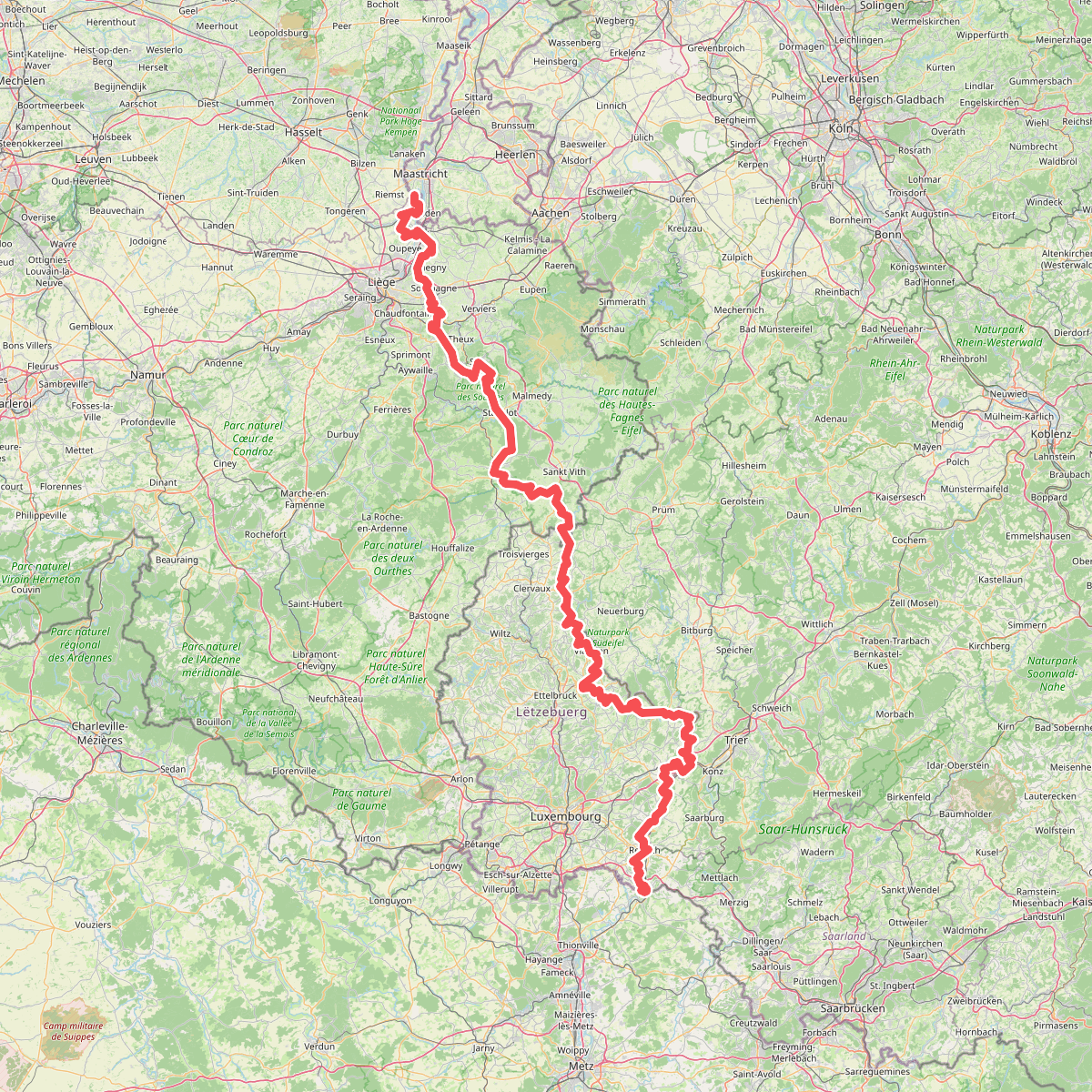
#6. Gr5 vanaf Maastricht
Riemst,Visé,Wonck,Haccourt,Feneur,Blegny,Soumagne,Olne,Trooz,Sprimont,Theux,Spa,La Gleize,Stavelot,Wanne,Vielsalm,Gouvy,Thommen,Reuland,Clervaux,Dasburg,Parc Hosingen,Putscheid,Vianden,Tandel,Bettendorf,Vallée de l'Ernz,Beaufort,Berdorf,Echternach,Rosport-Mompach,Condominium Lëtzebuerg-Deutschland,Mertert,Manternach,Wormeldange,Stadtbredimus,Remich,Schengen,Perl

#7. Greimerather Höhenweg
Losheim am See,Greimerath,Serrig

#8. Kaiserweg
Taben-Rodt,Mettlach

#9. König-Johann-Runde
Freudenburg,Mettlach,Kirf

#10. Maria-Croon-Weg
Mettlach,Freudenburg,Kirf,Trassem,Saarburg

#11. Nord Süd Trail, Abschnitt Erbeskopf - Saarschleife





